Sussex weather: When cold snap will end after 'potentially disruptive snow and ice' next week
and live on Freeview channel 276
The UK is ‘now in the grip’ of a ‘cold plunge of Arctic air’, which has moved in from the north across the whole of the country, the Met Office said.
A number of national severe weather warnings have been issued for ‘potentially disruptive snow and ice’ over the coming days.
Advertisement
Hide AdAdvertisement
Hide AdMet Office chief meteorologist, Andy Page, said: “Where and how much snow we will get will vary throughout the week and weather warnings could change quickly, you will need to keep an eye on the forecast for your region for the latest information.
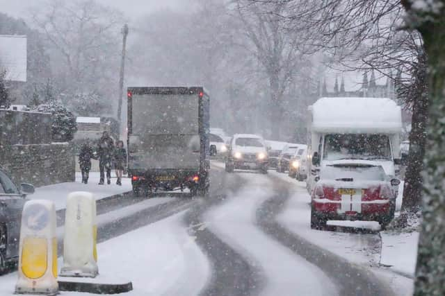

“There will be widespread frost this week and we could see some fairly deep laying snow in parts of northern UK and strong winds could result in drifting or blizzard conditions at times.
"The snow and ice will be disruptive and could potentially impact travel plans, make driving dangerous and pavements slippery.
“It will feel bitterly cold with daytime temperatures in the low single figures for many, and overnight temperatures will fall to -3 or -4 in many towns and cities, and it will be even colder in many rural areas.”
Advertisement
Hide AdAdvertisement
Hide AdThe UK Health Security Agency has a Cold-Health Alert in force for England, which highlights the possibility of significant impacts for the health and the social care sector. Click here to read more.
When will cold snap end?
As we move into mid-week, the Met Office said a low-pressure system will move across northern France – ‘bringing some snowfall on its northern edge’.
Met Office deputy chief meteorologist, Nick Silkstone, said: “The track of this system still has some small but all-important uncertainties tied to its northern extent, and it has the potential to bring some snow to southern England.
"However, our preferred solution suggests minimal snowfall (a couple of cm at most) across parts of the extreme south of England in association with this system, but we are keeping an eye on how things develop and will update the forecast as needed.”
Advertisement
Hide AdAdvertisement
Hide AdFrom Saturday (January 20) to Monday, January 29, we could see a ‘transition to less cold conditions’, as Atlantic frontal systems start to arrive from the west – ‘eventually bringing spells of rain and strong winds across all areas’.
A Met Office spokesperson added: “Following this transition, rain is likely to be heavy at times across many western hills.
"Whilst conditions will turn milder, this transition brings the chance of some transient snow for higher ground in the north of Scotland.
"Once established by the end of the weekend, milder and wetter than normal conditions seem most likely to persist through to late-January, although the south could have some drier spells of weather at times, especially later in the month, when the chance of overnight frost and fog increases once again.”
Advertisement
Hide AdAdvertisement
Hide AdThe Met Office also issued a long-range forecast for Tuesday, January 30 until Tuesday, February 13.
“After a likely milder, more unsettled spell during the preceding week, into early February there is again an increased likelihood of high pressure having greater influence on UK weather patterns,” a spokesperson said.
"There is uncertainty in exactly where high pressure will become established but this increases the likelihood of drier conditions.
"There is also a greater than normal likelihood of winds from the north or east leading to an increased chance, compared to normal, of cold spells.
"Whilst a drier and colder scenario is most likely during early February, there remains a lower chance of milder interludes with spells of rain and strong winds.”